
Walk a Plantation Street
Begin by proving where the address sits. A postal label may say Plantation when the parcel falls outside the municipal line, so use USPS to standardize the address and Plantation PGIS to check the boundary. The Broward County Property Appraiser, or BCPA, then supplies the folio, situs address, owner, mailing destination, legal description, municipality, building details, exemptions, and linked sales. These are assessment facts, not a list of everyone in the home.
The street directory trail becomes stronger when each source is given one job. Keep a worksheet with the exact spelling used by each office. Numbered streets and avenues, directional prefixes, unit numbers, and named subdivision roads can produce different matches if shortened too soon.
- Verify the mailing form with USPS, then confirm the city boundary in Plantation PGIS.
- Search the BCPA property roll by situs address and save the folio and legal description.
- Open the parcel map, inspect adjoining lots, and exclude roads, common areas, and government parcels.
- Carry the folio, owner name, and sale instrument into the Broward Official Records Search.
- Check Plantation permits and code cases, then use voter data or a verified reverse directory only for the narrower facts each can support.
Search Plantation Parcels by Address
BCPA is the main modern index behind a Plantation street directory. Search a site address, not the owner's mailing address. The site, or situs, is the land being assessed. Mail may go to a trust, company, post-office box, or a different home. A homestead exemption can support owner occupancy at the assessment date, but it still does not identify every household member.
| BCPA field | Input | Best use | Important limit |
|---|---|---|---|
| Owner Name | Last name or entity | Find parcels tied to a known owner | Try variants without punctuation |
| Address | Number and street | Locate the assessed site | Normalize direction and suffix |
| Property ID / Folio | Exact identifier | Return to one parcel | May display with or without hyphens |
| Subdivision / legal | Recorded description | Bridge old or missing addresses | Not a mailing address |
| Municipality / ZIP | Filter | Narrow broad results | ZIP does not prove city limits |
A parcel card may show the owner, mail and site addresses, folio, subdivision, use, values, exemptions, sales, building year, area, sketch, photo, and map links. Copy the sale book/page or instrument when shown. That key avoids a fresh broad-name search at the recorder.
Browse Plantation Streets in GIS
Plantation PGIS and Broward's BCPA GIS turn a single parcel hit into a street-by-street view. Search the address, zoom until parcel lines and labels appear, then click each lot in sequence. Useful layers include city boundary, addresses, streets, parcels, zoning, land use, water, code zones, and aerial imagery. If a layer blocks parcel clicks, switch it off before continuing.
The map is useful context, not a survey. It can show adjacency and connect a mapped polygon to a parcel card, but it cannot prove who occupies a building. There is no verified public export of all Plantation residents within a radius. Manual parcel review is the supported method.
- Parcel
- A separately assessed tract identified by a folio.
- Situs address
- The physical address of the assessed land, distinct from owner mail.
- Plat
- A recorded subdivision map that fixes lots, blocks, roads, and common areas.
- Criss-cross directory
- A historical volume arranged by street and house number rather than only by surname.
Plantation Street Records Compared
No single address source answers every question. The folio ties the property roll to maps and some recorded instruments, while the legal description remains stable when a street label or postal city changes. Names from one roll should be carried into the next source without changing the role attached to them.
| Address record | Keeper | What it contributes | Access |
|---|---|---|---|
| Assessment parcel | Broward Property Appraiser | Owner, mail, situs, legal, sales, building | Free owner, address, or folio search |
| Parcel map | Plantation and Broward GIS | Lot shape, nearby parcels, zoning, aerial | Free informational viewer |
| Deeds and liens | Broward RTT | Parties, title chain, legal, instruments | Web index plus counter or request |
| Permits and code | Plantation Accela | Work, dates, inspections, case events | Guest search; some actions require account |
| Voter file | Broward Elections | Nonexempt registered voters by residence | Public data request with exclusions |
| Reverse directories | Libraries and museum | Listed occupants by street in held years | Holdings must be confirmed |
This coverage table is a menu of evidence, not a household census. An owner's name, a permit applicant, and a voter at the same address may be three different people.
Turn Plantation Folios Into Deeds
Broward Records, Taxes and Treasury keeps the Official Records. Start with BCPA's linked sale instrument, then read the deed for its grantor, meaning seller, and grantee, meaning buyer. Confirm that the legal description matches. Search the seller as an earlier grantee to step backward. Liens, mortgages, satisfactions, probate papers, and plats may explain a transition, but they do not prove residence.
The web cutoffs matter. Full party-name search begins on July 7, 1977. A limited March 1972 to July 1977 band works through instrument number, book/page, book type, or date. Older county media reaches 1871 through the Search and Copy service, while principal web images begin in 1978. Plats remain searchable regardless of date. This exact divide is more useful than assuming every old deed appears in a modern name search.
The successful manifest capture comes from the Broward Records, Taxes and Treasury office page.
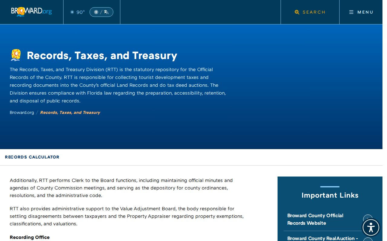
The office route matters when a Plantation deed is outside the searchable online name-index years or a certified copy is needed.
Plantation Addresses in Accela
The Plantation Accela Citizen Access portal adds dated municipal activity to the county parcel spine. Guest users can run basic searches across building, planning, local business tax, and enforcement records. Registered users can submit or manage certain transactions. Search by street number and name, then record the case or permit number, type, status, dates, work description, inspections, and any releasable applicant or contractor role.
A permit establishes work at an address, not continuous occupancy. Code records likewise document an event or condition. If the desired building era is not online, Plantation Building Safety provides a microfilm contact at 954-797-2783. Records outside the portals can also move through the City Clerk public-record request channel.
Note: Keep each named party's recorded role intact; an applicant, contractor, assessed owner, and resident are not interchangeable.
Plantation Voters Listed by Street
The individual voter lookup is an identity-gated self-service tool, not a way to browse a street. It generally requires a first name, last name, and birth date. For address-level research, the documented route is a registered-voter data request to the Broward Supervisor of Elections. Broward lists a $20 flat charge per voter-list database search, with extra delivery or custom-production costs in stated cases.
A public file can include a nonexempt voter's name, residence and mailing addresses, party, status, registration date, precinct, districts, and participation history. Participation shows that the voter received credit in an election, never the ballot choices. Confidential voters and protected identifiers are removed. The file also misses nonvoters, recent movers, children, and others whose address is exempt, so it can supplement a Plantation street directory but never complete one.
Older Plantation Streets on Shelves
A reverse or criss-cross directory is the true historical street tool because it orders entries by street and house number. Plantation's exact title and year run was not published in the official catalogs inspected. Do not assume a Polk series. Because the city incorporated in 1953 after suburban growth had begun, residents may instead appear in Fort Lauderdale or Broward regional telephone books, rural-route listings, subdivision headings, or neighboring postal designations.
Ask the Helen B. Hoffman Plantation Library, Plantation Historical Museum, Broward County Library local-history staff, and State Library reference desk for title, year, publisher, and reverse-section details before visiting. Once a held volume is confirmed, photograph its title page and abbreviation key as well as the entry. The historical collections and their interpretation are treated fully in the Plantation city directory resource.
Plantation Streets Outlast City Lines
Plantation's record geography grew westward. Frederick Peters bought about 10,000 acres in 1931, early construction centered on East Acre Drive, the city incorporated in 1953, and later annexation pushed toward Flamingo Road and Lago Mar. County deeds and plats may therefore predate a property's Plantation street address or its inclusion in city records.
No verified street-renumbering event was found, so none should be inferred. When an address fails, search the folio, lot, block, subdivision, plat book/page, and historic postal label. Annexation can change which city handles permits without breaking the Broward deed chain. This is why the durable legal description often outperforms street text in older street directory research.
Plantation Street Lookup Limits
A Plantation street directory can support ownership, mapped parcel context, listed voters, dated work, and historical directory entries. It cannot reveal a complete household. Renters, children, partners, new arrivals, utility customers, protected people, and unlisted residents may not appear. Driver-record addresses are restricted under federal law, and private delivery, school, gate, or membership files are not public substitutes.
Protected-person records may suppress names or addresses under Florida exemptions, and the Attorney General's Address Confidentiality Program gives qualifying participants a substitute mailing address. A blank result is not evidence that nobody lives at the property. It may mark a coverage gap, different spelling, exempt record, or source that indexes owners rather than occupants.
Lawful use. Use Plantation address records for lawful personal research. Never use public information to stalk, harass, threaten, or harm anyone.