
Plantation ZIP Code Coverage
Official city facility addresses establish six ZIP codes serving Plantation. They stretch from the original eastern and central area toward the west and southwest edges. None is a perfect city polygon. USPS assigns mail routes and labels, while Plantation and Broward County maintain government boundaries and parcels. Station names were not verified, so the table does not invent them.
| ZIP Code | Areas Covered | Post Office | Notes |
|---|---|---|---|
| 33317 | Original and eastern-central city; Park East | Verify with USPS | Includes City Hall; extends beyond a simple core |
| 33313 | Eastern and northeastern edge; PAL Park | Verify with USPS | Not exclusive to Plantation |
| 33322 | North- and west-central; Marcano Estates | Verify with USPS | Shared postal geography |
| 33323 | Western commercial and residential edge | Verify with USPS | Also associated with Sunrise |
| 33324 | Central and west; Midtown and University vicinity | Verify with USPS | Mailing ZIP differs from city polygon |
| 33325 | Far west and southwest; Melaleuca Isles and Mirror Lake | Verify with USPS | Also Davie and unincorporated geography |
No official source inspected identified a Plantation-only unique ZIP, a PO-box-only ZIP, or a verified realignment year. Nearby planning references to other codes do not add them to this evidence-based serving set. Check the address rather than expanding the list from a third-party ZIP site.
Western Plantation ZIP Geography
Plantation grew west from SR 7/US 441 toward Flamingo Road and annexed Lago Mar territory near 136th Avenue. Code 33322 covers north- and west-central places such as Marcano Estates. Code 33324 appears around central-west Plantation, Midtown, and the University area. Code 33323 sits on a western edge also linked by mail to Sunrise. Code 33325 reaches toward Melaleuca Isles, Mirror Lake, Davie, and unincorporated land.
This creates normal record mismatches. A Broward deed chain remains continuous when annexation moves a parcel into Plantation. The postal label can differ from the city with legal jurisdiction. Search the parcel’s municipality and legal description when the label on an envelope seems to conflict with city records.
Note: Annexation changes local jurisdiction, but it does not reset county title records or create a new deed chain.
Verify a Plantation ZIP Code
The USPS ZIP Code Lookup is the authority for mailing codes. By Address standardizes a complete address and returns ZIP+4. By City and State can overinclude places beyond Plantation, so it cannot settle jurisdiction. Next use Plantation PGIS for the city line and BCPA for the municipality and parcel.
| USPS field | Purpose | Limit |
|---|---|---|
| Street address | Standardizes a delivery point | Needs enough detail to resolve |
| City and state | Lists codes tied to a postal label | May include land outside city limits |
| Company | Helps resolve a business address | Does not prove jurisdiction |
| ZIP result | Returns five digits and ZIP+4 | Not a resident roll |
Open the official USPS address form shown below before checking the result against Plantation boundaries.
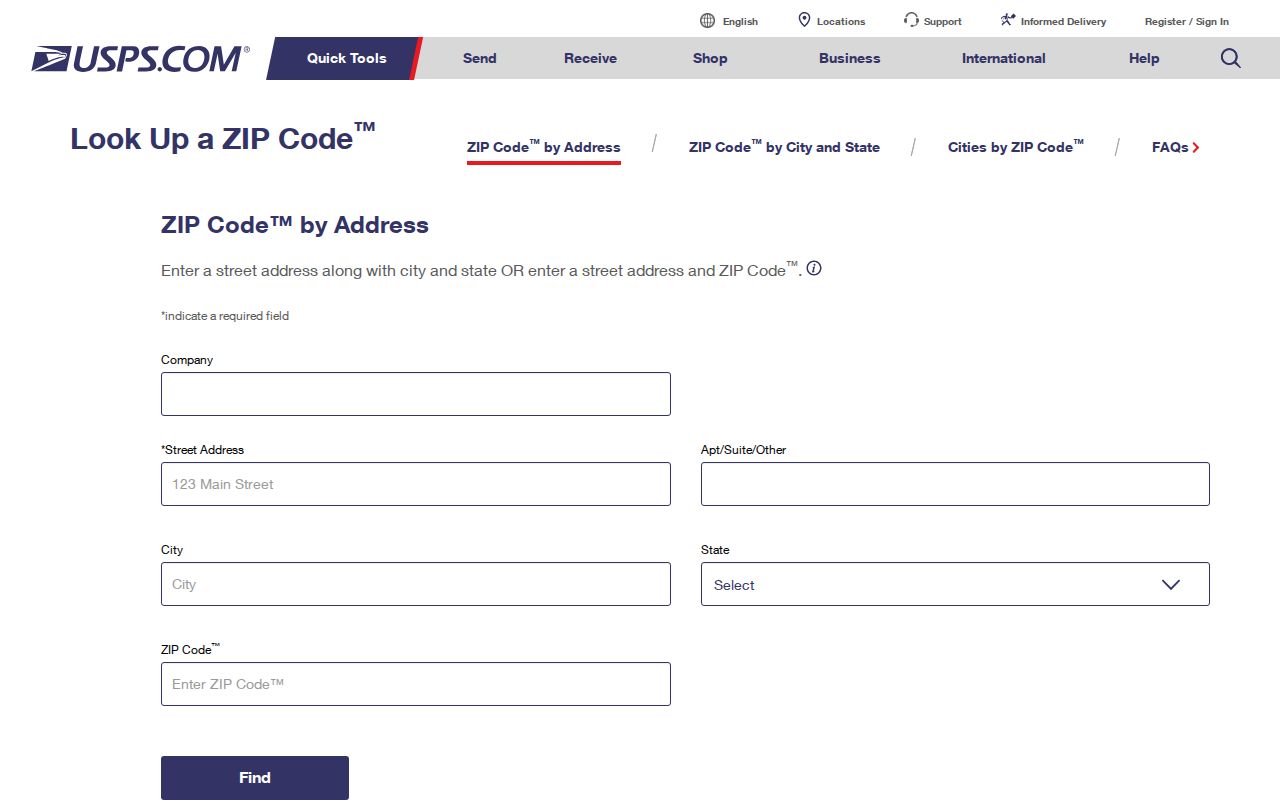
The postal answer is one layer of the search, not a substitute for the city map.
Find Plantation Residents by ZIP
Neither BCPA nor Plantation Accela was verified as an unrestricted ZIP-wide resident export. Use a ZIP code as a narrowing fact, then search a specific address or name. The voter self-lookup is identity-gated. A Broward voter-file request may include allowed residence fields, but protected voters and confidential identifiers are removed.
- Standardize the full address through USPS and record its ZIP+4.
- Check PGIS to see whether the point lies in Plantation.
- Open the BCPA parcel and compare situs, mailing, municipality, folio, and legal description.
- Use an authorized voter lookup or focused request only when it fits the question.
Once the ZIP code directory narrows the area, the Plantation street directory handles address-by-address work. A ZIP cannot show renters, children, unregistered adults, protected voters, or all household members.
Read Plantation Address Keys
BCPA’s situs address identifies the physical parcel. Its mailing address shows where tax correspondence goes. A deed may rely on lot, block, subdivision, condominium, plat book and page, or a metes-and-bounds legal description. Copy the folio exactly when moving between Broward systems.
Postwar plats can predate a street name or ZIP assignment. Plantation’s westward growth means a parcel may have county deeds from before city annexation. Legal descriptions preserve continuity better than a postal code. Permits and building years help date development, but do not prove occupancy.
Plantation ZIP Codes at Scale
The Census counted 91,750 Plantation residents in 2020 and estimated 99,183 on July 1, 2025. The city stretches between SR 7/US 441 and Flamingo Road, with Sunrise Boulevard and the North New River Canal framing much of its geography. ZIP areas overlap Sunrise, Davie, Fort Lauderdale labels, and unincorporated land.
The Census QuickFacts image supplies city context, not a ZIP-level household count.
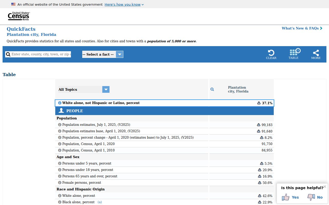
The figures explain common-name collisions across postal areas, but should not be split into unsupported per-ZIP estimates.
Plantation ZIPs Versus City Limits
USPS controls delivery geography; Plantation controls city services and jurisdiction. BCPA and county GIS connect a point to its parcel and municipality. A 33323 address can be associated by mail with Sunrise, while 33325 reaches Davie and unincorporated land. That is not necessarily an error, but the label cannot decide who handles permits, code cases, or roads.
- ZIP vs ZIP+4
- The five-digit area is broad; four added digits narrow a delivery segment.
- PO-box ZIP
- A code used mainly for boxes. None was verified as Plantation-only.
- Unique ZIP
- A code for one high-volume organization. None was verified here.
- Carrier route
- A group of postal delivery points, not a city boundary.
Boundary check. Verify mail with USPS, the city line with PGIS, and the parcel municipality with BCPA.